
Hi,
I have continued on CG and VG tests. I publish my questions here, but it concerns VG, (and CG too), but my tests are currently on VG.
My goal is to add some items on a village map, and to transform the 2D map into a 3D map, like your "City Viewer", but with 3D assets from Unity.
So, I exported PNG and JSON files from one VG seed. And I check the position of roads, buildings, trees. But I have some differences.
I have made "suppositions"/"interpretations" with the JSON file. I know that your JSON file is intended to be used only in CV, but I am interested by it.
So, I write a program which superposes PNG with polygons from JSON. I generated a 500x500 "dead end" village. The JSON gives me a 417x417 "earth" size (-208.6 to +208.6).
When I superpose a 417x417 resized PNG , with JSON, I got that :
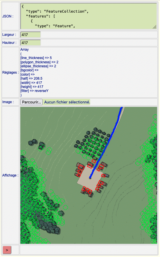
(blue=road, red=buildings,green=trees).
After several trials, I got the ideal size, which is 350 (70% of declared size ??) :
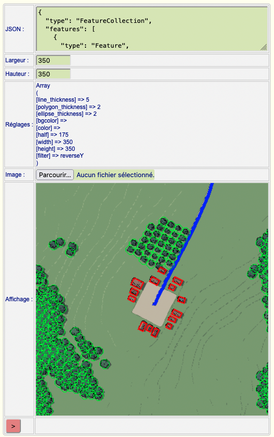
I have no idea if I made some geometric errors or miscalulations, or if there is something I forgot to include.
Do you have any idea ?
Mallatius